





X27
.png?imageMogr2/format/webp)
.png?imageMogr2/format/webp)
.png?imageMogr2/format/webp)
.png?imageMogr2/format/webp)
.png?imageMogr2/format/webp)
.png?imageMogr2/format/webp)
.png?imageMogr2/format/webp)
.png?imageMogr2/format/webp)
X27
GNSS Base Stations
Jumpstar X27 RTK Smart Antenna – Autonomous Driving-Optimized, IMU Integrated, Centimeter-Level Positioning, IP67 Industrial All-In-One Terminal
Autonomous Driving Oriented
Customized for autonomous driving control systems.
IMU + RTK Fusion Navigation
Built-in high-performance IMU, attitude & heading output.
Centimeter-Level RTK Accuracy
2.5cm±1ppm positioning, 0.2° heading@1m baseline.
Multi-Constellation Multi-Band
GPS/BDS-2/3/Galileo/QZSS/SBAS/IRNSS full signal support.
Rich Interfaces
CAN, RS232, RS485, 10-pin aviation connector for easy integration.
Multi-Mode Communication
4G Cat.1, BLE 5.2, Wi-Fi for flexible data transmission.
Industrial Reliability
IP67 waterproof, 9-36V wide voltage, -20℃~+75℃ operating temp.
Rover/Base Dual-Mode
Free switch between mobile station and base station.
Smart Status Indication
5 LED indicators + buzzer for real-time status feedback.
Remote OTA Upgrade
Supports remote firmware upgrade via network.
Jumpstar X27
RTK Smart Antenna
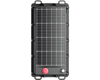
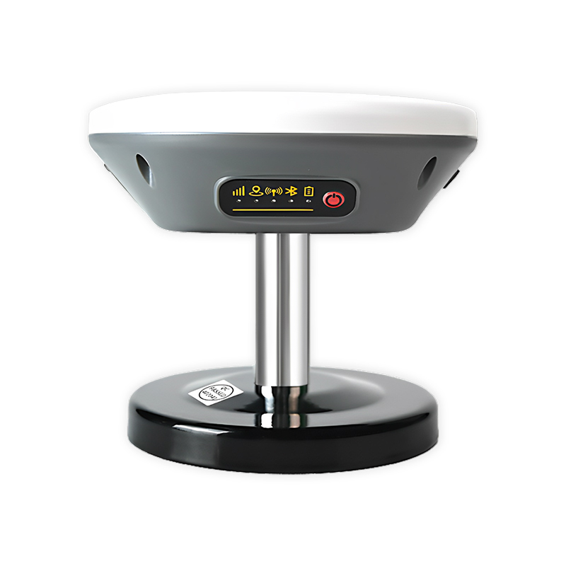
The X27 is a high-precision intelligent RTK smart antenna customized for autonomous driving scenarios. It integrates GNSS high-precision positioning, IMU integrated navigation, 4G Cat.1, Bluetooth 5.2, Wi-Fi, TF card data storage, SIM card slot, CAN, RS232, RS485 fault detection and buzzer alarm functions.
Equipped with a built-in backup battery and buzzer, it realizes accurate fault detection and status indication. Five LED lights intuitively display positioning, communication, power and other working statuses. It supports DC 9-36V wide voltage input and 10-pin aviation connector wiring, and can read TF card data flexibly through electronic switches. It is the ideal high-precision positioning terminal for autonomous driving control systems.
Autonomous driving oriented, IMU+RTK fusion, cm-level accuracy, rich interfaces, and industrial-grade reliability make X27 the optimal choice for vehicle-mounted high-precision applications.
.png?imageMogr2/format/webp)
Key Features & Benefits
-
Autonomous Driving Customization Specially designed for autonomous driving control systems, matching the high stability and real-time requirements of autonomous navigation.
-
IMU + RTK Fusion Positioning Built-in high-performance IMU sensor, supports combined navigation, attitude and heading angle output, heading accuracy 0.2°@1m baseline.
-
Ultra-High Precision Positioning RTK positioning accuracy 2.5cm±1ppm, single-point positioning ≤1.5m, velocity accuracy ≤0.02m/s, auxiliary dead reckoning error 3%d.
-
Multi-Constellation Multi-Band Compatibility Supports GPS, BDS-2/3, Galileo, QZSS, SBAS, IRNSS all satellite navigation signals, global available.
-
Rich Communication & Control Interfaces Equipped with CAN, RS232, RS485, 4G Cat.1, BLE 5.2, Wi-Fi, meets diversified communication and control integration needs.
-
Industrial-Grade Protection & Adaptability IP67 waterproof rating, operating temperature -20℃~+75℃, 9-36V wide voltage, adapts to harsh vehicle-mounted environments.
-
Smart Status & Maintenance 5 LED indicators + buzzer for real-time status feedback; supports SMS/serial port/Bluetooth configuration and remote OTA upgrade.
.png?imageMogr2/format/webp)
Technical Specifications
GNSS Performance
| Product Type | Autonomous Driving-Oriented RTK Smart Antenna |
| GNSS Signals | GPS: L1C/A, L2P, L2C, L5, L1C; BDS-2/3: B1I, B1C, B2a, B2b, B3I; Galileo: E1, E5a, E5b, E6c; QZSS/SBAS/IRNSS all bands |
| Positioning Accuracy | Single-point: ≤1.5m; RTK: 2.5cm±1ppm; Velocity: ≤0.02m/s |
| Heading Accuracy | 0.2°@1m baseline |
| IMU Parameters | Gyro: ±125°/s; Accelerometer: ±2g; Industrial-grade bias & stability |
| Sensitivity | Tracking: -155dBm; Acquisition: -140dBm |
| TTFF | Cold Start ≤30s; Hot Start ≤15s |
| Update Rate | 1~10Hz (Default 1Hz) |
| Supported Protocols | NMEA 0183, RTCM 3.3/3.2/3.1/3.0, JT/T808-2013 |
Electrical & Mechanical
| Communication | 4G Cat.1 (global bands); BLE 5.2 (30m); Wi-Fi (customizable) |
| Interfaces | CAN, RS232, RS485, 10-pin aviation connector, SIM/TF card slot, auxiliary antenna port |
| Power | Input: 9V-36V DC; Operating current: ≤200mA@12V; Backup battery: 380mAh 3.7V |
| Environmental | IP67; Operating temp: -20℃~+75℃; Storage temp: -40℃~+75℃; Humidity: 10%~85%RH non-condensing |
| Physical | Size: 128×128×50.5mm; Weight: 295g; Material: ASA |
| Certification | RoHS Compliant |
Typical Applications
Autonomous Driving Control Systems
High-precision positioning and heading for ADAS, autonomous vehicles and V2X applications
Unmanned Ground Vehicles (UGVs)
Autonomous navigation for unmanned ground vehicles and robotics
Intelligent Robot Navigation
High-precision heading and positioning for autonomous robots
Vehicle-Mounted High-Precision Positioning
High-precision navigation for vehicles, fleet management and telematics
Autonomous Logistics Vehicles
Autonomous navigation for delivery robots and logistics vehicles
Engineering Machinery Control
Precision control for construction and heavy equipment
Precision Agricultural Machinery
Automated guidance and heading control for agricultural equipment
Surveying & Mapping Integration
Integration into surveying systems for high-precision field data
Resources & Downloads
X27 Datasheet
Complete specifications, pinout, electrical and mechanical details.
Mechanical Drawing
2D/3D mechanical dimensions and pad layout (128×128×50.5mm).
User Manual
Quick start guide, integration tips, and configuration protocols.
3D CAD Model
STEP, IGES and STL formats for mechanical integration (128×128×50.5mm).
Frequently Bought Together
.jpg?imageMogr2/format/webp)
X28
Jumpstar X28 RTK Smart Antenna – IMU Fusion Navigation, Multi-Protocol Communication, IP67 Industrial All-In-One High-Precision Positioning Terminal
X11
Jumpstar X11 All-In-One RTK Smart Antenna – Centimeter-Level Positioning, 4G/BLE/Radio/Wi-Fi, IP66 Industrial-Grade Integrated Positioning Terminal