






JS-N66RK57-3
.png?imageMogr2/format/webp)
.png?imageMogr2/format/webp)
.png?imageMogr2/format/webp)
.png?imageMogr2/format/webp)
.png?imageMogr2/format/webp)
JS-N66RK57-3
UAV / Helical Antennas
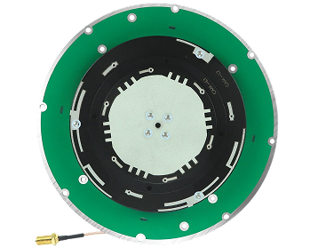
JS-N66RK57-3 Dual-Band RTK Positioning Module – 10Hz Update, Centimeter-Level Accuracy, Low Power, TTL/CAN Support.
High-Performance Chip
Uses high-performance chips for reliable and efficient GNSS positioning.
200 Tracking Channels
200 tracking channels for robust satellite signal acquisition and tracking.
Multi-Constellation & SBAS
Supports GPS, BDS, GLONASS, Galileo, QZSS and SBAS, with A-GNSS support.
Protocol Support
Supports standard NMEA 0183 and differential RTCM 3.X protocols.
Compact & Lightweight with Magnetometer Option
Compact size Φ66.00mm×21mm, weight <33g; optional magnetometer/compass.
Jumpstar JS-N66RK57-3
Dual-band RTK Positioning Module
JS-N66RK57-3 is a dual-frequency RTK positioning module based on BDS, GPS, GLONASS, Galileo, and QZSS. It adopts an advanced low-power design, providing ultra-low power consumption endurance without compromising performance.
JS-N66RK57-3 features advanced multipath and anti-interference RF front-end algorithms, effectively addressing positioning deviations caused by multipath and resisting external interference signals.
With 200 tracking channels, -165dBm tracking sensitivity, RTK centimeter-level accuracy (1.0cm+1ppm horizontal), 10Hz update rate, optional magnetometer/compass, and compact size Φ66.0×21mm, JS-N66RK57-3 is suitable for in-vehicle navigation, logistics scheduling, drones, and inspection robots.
.png?imageMogr2/format/webp)
Key Features & Benefits
-
High-Performance Chip Uses high-performance chips for reliable and efficient GNSS positioning.
-
200 Tracking Channels 200 tracking channels for robust multi-constellation satellite signal tracking.
-
Multi-Constellation & SBAS Supports GPS, BDS, GLONASS, Galileo, QZSS, SBAS and IRNSS.
-
RTK Centimeter-Level Accuracy RTK horizontal accuracy 1.0cm+1ppm, vertical 1.5cm+1ppm CEP.
-
Protocol Support Supports NMEA 0183, RTCM 3.X differential data, and custom binary protocols.
-
Compact & Lightweight Compact size Φ66.00mm×21mm±0.3mm, weight <33g, optional magnetometer/compass.
-
Low Power & AGPS Advanced low-power design, AGPS support, wide voltage range 3.5-12V.
.png?imageMogr2/format/webp)
Technical Specifications
GNSS Performance
| Receiver Type | Dual-frequency RTK positioning module based on BDS, GPS, GLONASS, Galileo, and QZSS |
| Supported Constellations | GPS/QZSS (L1, L5), GLONASS (G1), Galileo (E1, E5), BDS (B1I, B1C, B2a, B2b, B2I), IRNSS (L5), SBAS |
| Tracking Channels | 200 tracking channels |
| Sensitivity | Tracking: -165dBm; Hot Start & Reacquisition: -159dBm; Cold Start: -148dBm |
| Time to First Fix | Cold Start: 28s; Hot Start: 1s; AGPS: 1.5s |
| Positioning Accuracy | Single Point: Horizontal 1.0m CEP, Vertical 2.0m CEP; RTK: Horizontal 1.0cm+1ppm CEP, Vertical 1.5cm+1ppm CEP |
| Time Pulse Signal Accuracy | PPS <20ns (RMS) |
| Speed Accuracy | 0.1m/s CEP |
| Operational Limits | Max Acceleration ≤4g; Max Speed ≤500m/s; Max Height 20000m |
| Baud Rate | 9600 ~ 921600bps (Default: 115200bps) |
| Max Update Rate | 10Hz (Default: 1Hz) |
| Supported Protocols | NMEA 0183, RTCM 3.X, Custom Binary |
| A-GNSS / SBAS Support | Supports AGPS and SBAS |
Electrical & Mechanical
| Antenna Type | Passive ceramic antenna: L1 (25×25×2mm), L5 (36×36×2mm) |
| Pin Interfaces | SDA (IIC Data), SCL (IIC Clock), RX/CL (GNSS receive), TX/CH (GNSS send), VCC (3.5-12V), GND |
| Power Supply Voltage | 3.5V ~ 12.0V (Typical: 5.0V) |
| Operating Current | 47~60mA@5V (Typical: 55mA); CAN adds ~8mA |
| Backup Battery Voltage | 1.8V ~ 3.6V (Typical: 3.3V) |
| Backup Battery Current | 14µA @ 3.3V |
| Backup Battery Capacity | 0.033F |
| Storage Temperature | -40°C ~ +85°C |
| Operating Temperature | -40°C ~ +85°C (without Farad capacitor) |
| Farad Capacitor Temp. | -25°C ~ +60°C (hot start not available outside this range) |
| Humidity | 95% (non-condensing) |
| Mechanical Dimensions | Φ66.00mm × 21mm ±0.3mm |
| Weight & Compliance | Weight <33g; RoHS compliant |
Typical Applications
Drone Applications
Positioning & Navigation
Intelligent Logistics Scheduling
Positioning & Navigation
Unmanned Driving
Positioning & Navigation
Precision Agriculture & Positioning Services
Positioning & Navigation
Measurement and Surveying
Positioning & Navigation
Autonomous Robots
Positioning & Navigation
On-Board Equipment Applications
Positioning & Navigation
Precision Control
Positioning & Navigation
Frequently Bought Together
.png?imageMogr2/format/webp)
JS-HAC41A
The JS‑HAC41A is a multi‑constellation, full‑band high‑precision helical antenna designed for GNSS applications. It covers GPS, BDS, GLONASS, and Galileo signals, offering excellent low‑elevation gain, wide‑angle circular polarisation, and a stable phase centre. With its integrated LNA and compact form factor, it is well suited for UAVs, surveying and mapping, aerial photography, navigation dispatching, disaster monitoring, and container terminal operations.
.png?imageMogr2/format/webp)
JS-N80UP-9
JS-N80UP-9 Multi-GNSS L1 Receiver – 25Hz Update, High Sensitivity, Multi-Interface (UART/CAN/RS232), Compass Support.
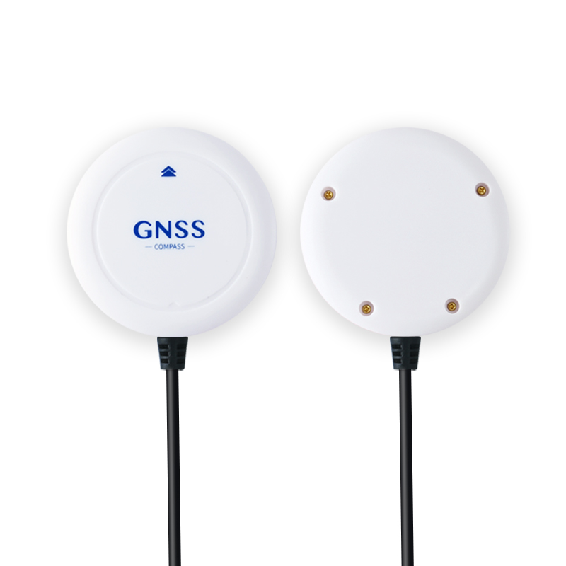
JS-N27UP36-9
JS-N27UP36-9 Multi-GNSS L1 Module – Low Power, 25Hz Update, High Sensitivity (-167dBm), Integrated Antenna, Active/Passive Support.