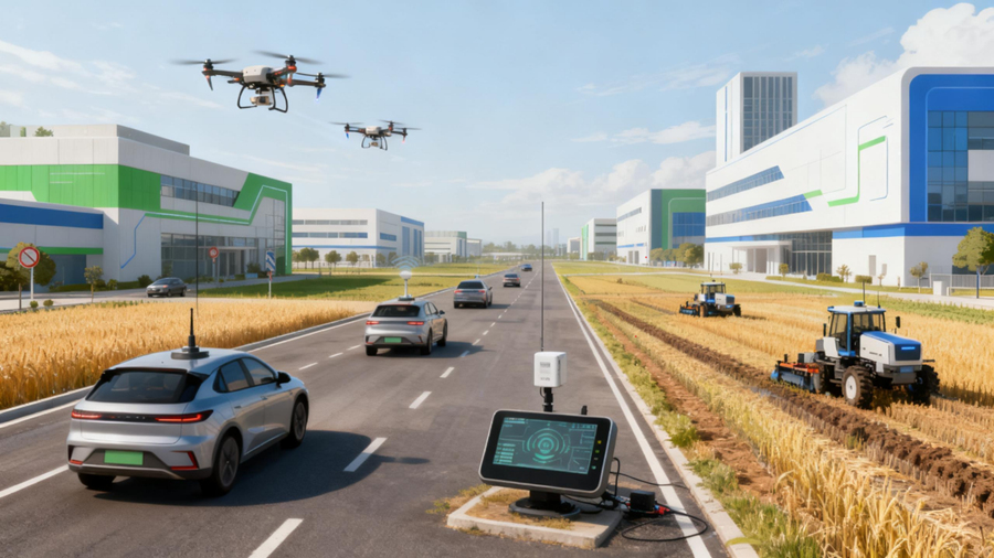





Embodied AI systems act in the physical world: they perceive their surroundings, make decisions and move. Much of the current discussion centres on models and manipulation skills, but every physical action depends on an earlier, quieter question — where am I, and how am I moving? GNSS RTK for embodied AI robots is one way to answer that question outdoors, providing high-precision absolute positioning where satellite reception and correction data allow. This guide explains what RTK contributes to robot localization, how it relates to SLAM and other sensors, and what robotics engineers should evaluate before integrating it.
What Is Embodied AI and Why Does Localization Matter?
Embodied AI refers to intelligence that operates through a physical body — a humanoid robot, a mobile manipulator, an autonomous platform. The loop is familiar to control engineers: perceive the environment, decide, act, and observe the result. What distinguishes embodied systems from purely digital ones is that every decision ultimately executes through motors contacting real ground under real physical constraints.
Localization sits underneath that loop. A inspection robot that cannot estimate its own position cannot report where a fault was found; a delivery robot that drifts between buildings arrives at the wrong entrance. Position, orientation and motion estimates feed path planning, task assignment, mapping and safety logic. The quality of those estimates directly bounds what the rest of the system can achieve, regardless of how capable the AI layer is.
Why Vision and SLAM May Need an Absolute Positioning Reference
Most mobile robots localize with onboard perception: cameras, LiDAR, visual odometry, wheel encoders and IMUs, commonly tied together by SLAM (Simultaneous Localization and Mapping). These technologies answer a local question — how the robot has moved relative to features it observes around itself. They are excellent at navigating a known facility or building a map of a new one.
They are less suited, on their own, to answering a global question: where is this robot in geographic coordinates, relative to a site map, another vehicle, or yesterday's inspection route. Relative estimates accumulate error over time and distance, and a map built indoors says nothing about the car park outside.
This is the gap an absolute positioning reference fills. GNSS positions are expressed directly in a geographic reference frame, without requiring prior mapping of the environment. Whether a given robot needs that reference depends on the operating environment, accuracy requirements, navigation architecture, availability of GNSS signals, and cost and power constraints — not every robotic system requires both GNSS and SLAM.
How GNSS RTK for Embodied AI Robots Supports Robotic Localization
Standard GNSS positioning delivers metre-level accuracy, which is often too coarse for a robot navigating between known waypoints. RTK (Real-Time Kinematic) refines the measurement by combining the rover receiver's carrier-phase observations with correction data from a base station at a known location, or from a network correction service. Under suitable conditions, the resulting position is precise enough to place a robot on a centimetre-scale site map.
For an embodied AI platform, that output becomes one input to the navigation stack: periodic position updates in a global frame that the localization layer can blend with its own motion estimates. RTK performance is never unconditional. It depends on satellite visibility, correction data availability, multipath from nearby structures, antenna placement, receiver capability, environmental conditions and the overall system integration. Centimetre-level figures in a datasheet are specifications under defined conditions, not guarantees in every environment.
GNSS RTK and SLAM: Complementary Roles in Robot Navigation
GNSS RTK and SLAM are often presented as alternatives; in practice they do different jobs. The comparison below summarizes the typical division of labour.
| Aspect | GNSS RTK | SLAM / visual-inertial odometry |
|---|---|---|
| Reference frame | Global / geographic coordinates | Local map or body-relative frame |
| Long-term drift | Bounded by satellite geometry and corrections | Accumulates with distance travelled |
| Environment | Requires open sky view | Works indoors and outdoors with usable features |
| Environmental understanding | Position only | Obstacles, structure and free space |
Combining them can reduce dependence on any single sensor: GNSS anchors the map to the real world and keeps long-term error bounded, while SLAM carries the robot through short outages and interprets its surroundings. That resilience is a design property, not an automatic one — fusion must be engineered and validated. Indoors, underground, in urban canyons and in heavily obstructed areas, satellite positioning may be unavailable altogether, and other positioning methods are required.
Key GNSS Integration Challenges for Embodied AI Robots
Integrating GNSS into a mobile or humanoid robot raises engineering questions that a fixed installation never meets.
- Size and weight: Compact platforms and humanoids have strict payload and volume budgets, which pushes designs toward modules and small antennas rather than boxed receivers.
- Power consumption: The GNSS chain draws continuously from the robot's battery, so its budget must be evaluated alongside drive and compute loads.
- Antenna placement: The antenna needs the clearest possible sky view. On a humanoid the head is a candidate but is frequently tilted; on mobile platforms, roof or mast placement trades visibility against height and impact risk.
- Dynamic motion: Changing posture, vibration and rapid orientation changes affect signal reception and multipath conditions. The scale of the effect varies with the platform and should be measured, not assumed.
- Time synchronization: Fusing GNSS with IMU, camera and LiDAR data requires consistent timestamps across sensors. The precision needed is application-dependent and should be defined before hardware is chosen.
- Interfaces and communication: Output formats, update rates and electrical interfaces between the GNSS component and the robot's main controller must be confirmed on both sides.
- Signal availability: Indoor aisles, tunnels, dense campuses and areas beside large structures can block or degrade satellite signals; the operating map should be surveyed for this early.
How to Select GNSS Hardware for Embodied AI Applications
The right product form depends on how deep the integration goes and what stage the project is at.
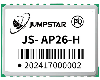
- GNSS modules suit teams embedding positioning directly into their own carrier board, with control over layout, power and interfaces.
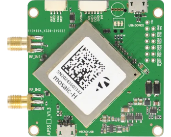
- GNSS OEM boards offer higher capability and connectorized integration for custom navigation units and small production runs.
- RTK receivers and systems provide a complete, configured solution for prototyping, field trials and platforms where engineering effort should go elsewhere.
- GNSS antennas deserve as much attention as the receiver — element type, mounting, cable loss and multipath behaviour shape real-world accuracy.
- Evaluation kits let teams test signal behaviour, correction workflows and interface performance on the actual robot before committing to a design.
The decision should weigh development stage, integration depth, size and power constraints, positioning requirements, antenna configuration, correction data source, interfaces, software architecture, production volume and the level of supplier support required. No single category fits every robot.
JUMPSTAR GNSS Solutions for Robotics and Autonomous Systems
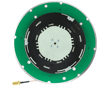
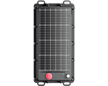
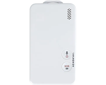
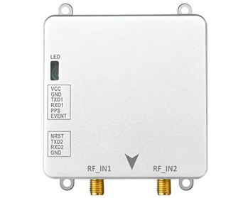
JUMPSTAR provides a portfolio spanning GNSS modules, GNSS OEM boards, RTK receivers and systems, and GNSS antennas, together with evaluation kits for development teams. These product families are used across UAV, surveying, vehicle and industrial positioning applications, and the same building blocks — multi-constellation receivers, RTK processing, and matched antennas — are what a robotics integration typically starts from.
For embodied AI development, the practical approach is to shortlist products by integration form factor and interface requirements, then evaluate specific models against the robot's actual motion profile and environments. JUMPSTAR's technical team can advise on module and antenna selection for specific integration requirements; suitability should always be confirmed through evaluation on the target platform.
Indoor-Outdoor Navigation and Multi-Sensor Integration
Few robots live in one environment. An outdoor inspection robot may start in a charging bay inside a building; a delivery robot crosses open ground, passes between buildings and enters covered corridors. Each zone favours different positioning inputs:
- Open outdoor areas: RTK positioning with good satellite geometry is typically the primary reference.
- Partially obstructed areas: RTK availability becomes intermittent; the localization layer must degrade gracefully, often leaning more on odometry and perception.
- Indoors and tunnels: Satellite positioning is generally unavailable; SLAM, visual-inertial odometry and local technologies such as UWB take over.
- Dense urban environments: Multipath and sky blockage demand careful antenna placement and realistic accuracy expectations.
A production architecture therefore combines several of these inputs, with a fusion layer that weighs each source according to conditions. The right mix is determined by the robot's operating environment and requirements, and should be validated in field tests that cover the actual routes the robot will run.
Questions Engineers Should Ask Before Integrating GNSS RTK into a Robot
Before committing hardware, engineering and procurement teams should be able to answer:
- What positioning accuracy does the application actually require?
- Will the robot operate indoors, outdoors, or in mixed environments?
- Is RTK correction data available across the operating area, and from what source?
- What antenna configuration and mounting location are physically possible on this platform?
- What are the size, weight and power budgets for the GNSS chain?
- Which interfaces and data formats does the robot's main controller expect?
- How will GNSS data be synchronized with the IMU, cameras and LiDAR?
- How should the system behave when GNSS signal is lost?
- Is sensor fusion handled in-house, or does it need supplier support?
- What field testing on representative routes is planned before deployment?
Conclusion
Localization is a foundation of embodied AI: a robot that cannot place itself cannot act reliably in the world. GNSS RTK for embodied AI robots serves as an absolute positioning reference for outdoor and partially open operation, complementing — not replacing — SLAM, IMUs and perception sensors that handle local navigation and environmental understanding. Realizing that value depends on disciplined hardware selection, careful antenna and interface integration, and application-specific validation across the robot's real operating routes. If you are evaluating positioning components for a robotics platform, explore JUMPSTAR's GNSS modules, OEM boards, receivers and antennas, or contact the technical team to discuss your integration requirements.
.png?imageMogr2/format/webp)
.png?imageMogr2/format/webp)