

Introduction
Modern container terminals are undergoing a fundamental transformation. Rapidly growing cargo volumes, persistent labor shortages, and relentless pressure to improve operational efficiency are driving ports around the world toward intelligent automation. At the heart of this digital shift lies one critical enabler: high-precision positioning.
In today's advanced port terminals, ship-to-shore cranes lift 40-ton containers with millimeter precision, autonomous guided vehicles navigate container yards without human operators, and rail-mounted gantry cranes stack containers five-high with automated precision. None of this would be possible without RTK GNSS receivers delivering centimeter-level position data in real time.
This article explores how RTK positioning technology is reshaping smart port operations — from crane automation and vehicle guidance to container tracking and worker safety. It examines the operational challenges that make precision positioning indispensable, the specific applications driving measurable ROI, and how JUMPSTAR's RTK solutions support the next generation of intelligent port infrastructure.
Challenges Facing Modern Smart Port Operations
The world's busiest container terminals now handle millions of TEUs annually. A single vessel call may involve thousands of container moves across shore cranes, yard cranes, and horizontal transport vehicles — all coordinated within tight time windows. As throughput demands increase, traditional operational methods are reaching their limits.
Escalating Container Throughput
Global container trade has grown at a compound annual rate exceeding 5% for the past two decades. Mega-vessels carrying 24,000+ TEU are now routine at major hub ports. Each vessel turnaround involves coordinating dozens of pieces of equipment simultaneously — a complexity that manual operation and basic GPS cannot reliably manage.
Precision Crane Alignment
Ship-to-shore (STS) cranes must position spreaders precisely over container corner castings — a tolerance of just a few centimeters from heights exceeding 40 meters. In the yard, rail-mounted gantry (RMG) cranes stack containers in dense blocks where millimeter-level alignment determines whether a lock engages correctly. Traditional positioning, relying on operator skill and visual judgment, introduces variability that accumulates into costly delays and safety risks.
Vehicle Coordination and Routing
A busy terminal may operate dozens of internal transfer vehicles, straddle carriers, and automated guided vehicles (AGVs) simultaneously. Without precise, real-time location data for every vehicle, congestion builds, idle time accumulates, and asset utilization plummets. Conventional GNSS — with its 2-5 meter accuracy — cannot reliably distinguish which lane a vehicle occupies or whether it has reached the exact loading position.
Personnel Safety in Mixed-Traffic Environments
Port terminals are hazardous workplaces where heavy machinery and personnel share operating zones. Container handling equipment weighing hundreds of tons operates at close quarters. Without accurate positioning, collision avoidance systems lack the spatial awareness necessary to protect workers in dynamic, high-activity environments.
Asset Visibility and Container Tracking
Knowing where every container is — in real time — is fundamental to terminal efficiency. Manual tracking or RFID-based systems provide only checkpoint-level visibility. A container that is misplaced by a single stack position can trigger cascading delays across vessel loading, yard operations, and gate transactions.
Why RTK GNSS Is Transforming Smart Ports
Real-Time Kinematic (RTK) GNSS delivers centimeter-level positioning by combining satellite signals from a fixed reference station with correction data transmitted to mobile receivers deployed on cranes, vehicles, and other equipment. This technique eliminates the ionospheric, tropospheric, and orbital errors that limit conventional GNSS to meter-level accuracy.
How RTK Works — A Simplified View
A base station installed at a precisely surveyed fixed location within the port continuously monitors GNSS satellite signals and calculates the difference between its known position and the position computed from satellite data. This differential correction is broadcast in real time — typically via the port's wireless communication network — to every RTK-enabled rover receiver on cranes, vehicles, and monitoring equipment. Each rover applies the correction to its own satellite measurements, achieving horizontal accuracy of 1-2 centimeters and vertical accuracy of 2-3 centimeters — sufficient for the most demanding port automation tasks.
What Makes RTK Different for Port Applications
Unlike general-purpose GNSS, RTK enables several capabilities that are mission-critical for port automation:
Continuous, drift-free positioning. RTK corrections arrive every second or faster, maintaining accuracy without the gradual degradation that affects dead-reckoning or inertial-only solutions. This is essential for applications where a positioning error of even 10 centimeters could result in a missed container lock or a collision.
Multi-constellation, multi-frequency reception. Modern RTK receivers track GPS, BDS, GLONASS, Galileo, and QZSS across L1, L2, and L5 bands simultaneously. In port environments characterized by metal structures, container stacks, and vessel superstructures — all of which cause signal blockage and multipath reflections — redundant satellite signals across multiple frequencies dramatically improve availability and reliability.
Anti-interference and anti-spoofing capabilities. Ports are increasingly concerned with GNSS signal integrity. Advanced RTK receivers incorporate interference detection algorithms, multipath suppression, and spoofing protection to ensure that positioning data remains trustworthy even in challenging electromagnetic environments.
In automated container terminals deploying RTK GNSS, crane-to-vehicle relative positioning accuracy has been demonstrated at ±5 cm with heading deviation under 0.3° — enabling autonomous handoff operations where spreaders engage containers without human visual confirmation.
Key Smart Port Applications
RTK GNSS receivers enable a spectrum of positioning-dependent applications across the container terminal. Each application has distinct accuracy, reliability, and integration requirements — and each delivers quantifiable operational improvements.
1. RTK Positioning for Ship-to-Shore Cranes (STS)
Ship-to-shore cranes are the primary loading and unloading interface between vessels and the terminal. An STS crane operator — or increasingly, an automated control system — must position a spreader weighing several tons precisely above the target container's corner castings, lower it, lock the twistlocks, and lift — all while the vessel may be moving with tide, wind, and ballast changes.
RTK receivers mounted on the crane trolley and spreader provide real-time 3D position data with centimeter-level accuracy. This enables the crane control system to: automatically guide the spreader to the target container position derived from the vessel's stowage plan; maintain precise positioning during the entire lift cycle; detect and avoid potential collisions with vessel structures, adjacent container stacks, and waiting trucks; and verify spreader-to-container alignment before engaging twistlocks.
The result is faster vessel turnaround times, significantly reduced risk of container and vessel damage, and the ability to operate reliably in low-visibility conditions — rain, fog, or nighttime — when manual operation would normally slow or stop.
2. RTK Positioning for Rail-Mounted Gantry Cranes (RMG)
RMG cranes span container stacks in the yard, moving on fixed rails across rows of containers that may be stacked five or more high. Their job is to receive containers delivered by internal transfer vehicles and stack them in designated positions, or retrieve stacked containers for onward transport.
RTK positioning enables RMG cranes to operate fully automatically: the crane travels to the precise yard position specified by the terminal operating system, the trolley positions the spreader over the target container, and the hoist lowers and engages — all guided by real-time centimeter-level GNSS coordinates integrated with a 3D yard map.
Terminals deploying RTK-equipped RMG cranes have reported yard handling efficiency improvements exceeding 30% and significant reductions in container handling incidents. The elimination of operator cabins on each crane reduces labor requirements while enabling one operator to remotely supervise multiple automated cranes simultaneously.
3. Autonomous Container Trucks and AGVs
Horizontal transport — moving containers between the quay and the yard — represents a major operational cost center. Traditionally, this relied on fleets of manually driven internal transfer vehicles. Today, leading terminals deploy autonomous guided vehicles (AGVs) and autonomous container trucks that navigate the terminal using RTK GNSS as their primary positioning sensor.
RTK delivers several capabilities that make autonomous horizontal transport viable: lane-level navigation that distinguishes which lane a vehicle occupies even in multi-lane terminal roads; precise docking at crane transfer points where positioning accuracy directly determines whether automated handoff succeeds; real-time fleet coordination that enables the terminal operating system to optimize routing, minimize congestion, and reduce empty-run distances; and consistent performance regardless of weather, lighting conditions, or time of day.
4. Container Tracking and Asset Management
Beyond crane and vehicle positioning, RTK GNSS enables real-time container-level visibility. Positioning terminals mounted on containers or integrated into chassis provide continuous location data that feeds into the terminal operating system. This transforms container management from checkpoint-based tracking — where a container's location is known only when it passes a reader gate — to continuous position monitoring across the entire terminal footprint.
Benefits include: reduced search time for misplaced containers, which in large terminals can consume hours of equipment and labor; improved dispatch efficiency by directing the nearest available crane or truck to the exact container position; enhanced inventory accuracy that supports just-in-time vessel loading; and better security through geofencing and unauthorized-movement alerts for high-value or hazardous containers.
Key Benefits of RTK GNSS for Port Operators
Higher Operational Efficiency. Automated crane positioning reduces single-box handling cycles, increases crane productivity, and shortens vessel berth time. Automated vehicles reduce idle time and improve transport asset utilization.
Improved Worker Safety. Centimeter-accurate equipment positioning provides the spatial confidence needed for effective collision avoidance systems. Personnel tracking terminals enable geofencing and proximity alerts that protect workers in mixed-traffic zones.
Reduced Labor Dependency. One operator can remotely supervise multiple automated cranes. Autonomous vehicles eliminate driver requirements. Container tracking automation reduces manual inventory checks. Cost savings are substantial and recurring.
Lower Operating Costs. Reduced equipment damage, lower insurance premiums, optimized energy consumption, and higher asset utilization all contribute to measurable cost reduction. Ports deploying comprehensive RTK automation have reported operating cost reductions in the range of 15-25%.
Better Equipment Utilization. Real-time positioning data enables the terminal operating system to dispatch the nearest available equipment, minimize empty travel, and balance workload across crane and vehicle fleets — increasing utilization rates and reducing capital expenditure requirements.
Future-Ready Infrastructure. RTK GNSS provides the positioning backbone that supports emerging technologies: AI-powered dispatch optimization, digital twin modeling, predictive maintenance, and fully unmanned terminal operations.
Recommended JUMPSTAR RTK Solutions
JUMPSTAR provides a comprehensive portfolio of high-precision GNSS positioning solutions designed for the demanding operational environments of modern container terminals. Two products are particularly well-suited to smart port applications.
JS-UK39-F: RTK GNSS Receiver Module for Fixed Infrastructure
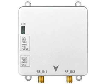
The JS-UK39-F is a multi-constellation, multi-frequency RTK GNSS receiver module engineered for integration into fixed and semi-fixed positioning infrastructure. With 192 search channels, 60 dedicated tracking channels, and tracking sensitivity of -167 dBm, it maintains reliable satellite lock even in port environments where container stacks and metal structures create challenging signal conditions.
For smart port applications, the JS-UK39-F is ideally suited for permanent installation on STS cranes, RMG cranes, and port infrastructure. Its L1/L2 dual-frequency reception delivers RTK horizontal accuracy of 1 cm + 1 ppm with convergence times under 10 seconds — fast enough for dynamic crane positioning. The module's 25 Hz update rate ensures smooth motion tracking during trolley and gantry travel, while its compact 25.0 × 39.4 × 11.6 mm footprint simplifies integration into existing crane control systems.
The JS-UK39-F operates from 3.3–5.5 V DC with tracking current as low as 77 mA at 5 V, making it power-efficient for always-on applications. Its -40°C to +85°C operating temperature range and industrial-grade anti-interference design ensure reliable year-round operation in coastal and outdoor port environments. Standard NMEA 0183, RTCM 3.3, and UBX protocol support facilitates straightforward integration with existing terminal operating systems and crane PLC controllers.
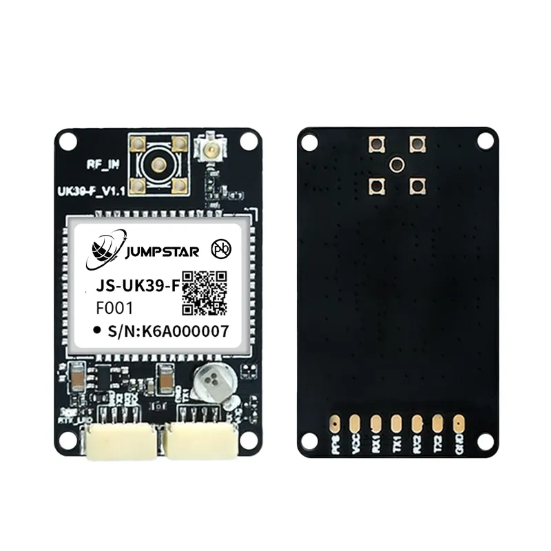
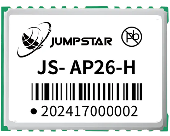
JS-UK39-F: Multi-constellation RTK GNSS receiver module for port infrastructure positioning
X43H-AH: Professional RTK Receiver for Autonomous Vehicles and Crane Automation
The X43H-AH is a next-generation multi-constellation, multi-frequency RTK receiver designed for the most demanding positioning and heading applications. With 789 hardware channels, it simultaneously tracks all visible GNSS satellites across GPS, BDS, GLONASS, Galileo, and QZSS constellations on L1, L2, and L5 bands — providing the signal redundancy and robustness that port automation demands.
What distinguishes the X43H-AH for port applications is its dual-antenna heading capability. In addition to RTK position (0.6 cm + 0.5 ppm horizontal), the receiver outputs heading, pitch, and roll angles without relying on magnetic sensors. With a 1-meter antenna baseline, it delivers 0.15° heading accuracy; at 5 meters, accuracy improves to 0.03°. For autonomous AGVs, container trucks, and unmanned terminal vehicles, this heading data is essential for precise steering control and accurate docking at crane transfer points.
The X43H-AH is engineered for high-dynamic and high-reliability applications. Its 20 Hz data update rate with sub-10 ms latency (99.9th percentile) ensures responsive control-loop performance, while AIM+ interference detection, LOCK+ anti-vibration tracking, IONO+ ionospheric protection, and APME+ multipath suppression provide multi-layer protection against the signal degradation common in port environments. Built-in OSNMA anti-spoofing further ensures positioning integrity — an increasingly important consideration for security-sensitive port operations.
With a 43.8 × 34.0 × 11.5 mm form factor weighing under 25 g, 3.5–12 V wide voltage input, -40°C to +85°C operating range, and rich interface options including UART, USB, CAN, SPI, and Ethernet, the X43H-AH integrates seamlessly into AGV navigation controllers, crane automation systems, and autonomous vehicle platforms.
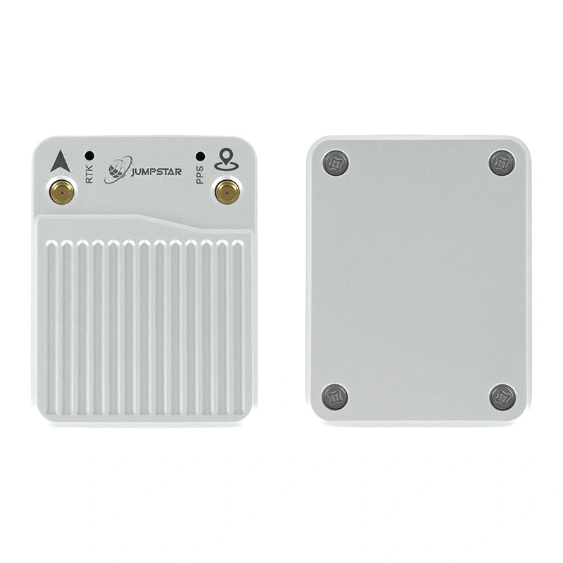
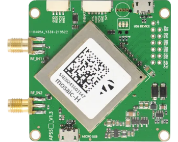
X43H-AH: Professional RTK receiver with dual-antenna heading for autonomous port vehicles and crane automation
Future Trends in Smart Port Automation
The trajectory of port automation points toward increasingly autonomous operations, and positioning technology will remain at the center of this evolution. Several trends are shaping the future:
AI-powered terminal orchestration. Machine learning algorithms will process real-time positioning data from hundreds of RTK-equipped assets to optimize equipment assignment, routing, and sequencing dynamically — adjusting in real time to vessel delays, equipment failures, and changing operational priorities.
Digital twin integration. High-precision RTK positioning data will feed continuously into digital twin models that mirror every container, vehicle, and crane in the terminal. This enables simulation-based planning, predictive what-if analysis, and remote operations management from anywhere in the world.
Multi-sensor fusion. RTK GNSS will increasingly be combined with LiDAR, cameras, inertial measurement units (IMUs), and ultra-wideband (UWB) ranging to create redundant positioning systems that maintain accuracy even when GNSS signals are temporarily blocked — under crane booms, inside container stacks, or beneath vessel superstructures.
Fully unmanned terminals. As positioning reliability approaches 99.999% availability, terminals will move toward fully unmanned operations where all quayside and yard equipment operates autonomously, controlled by a central intelligent dispatch system built on centimeter-accurate, real-time positioning data.
Conclusion
High-precision positioning has moved from a nice-to-have capability to an essential infrastructure requirement for modern container terminals. The economic pressures of growing cargo volumes, labor constraints, and competition mean that terminals must extract maximum productivity from every piece of equipment and every square meter of yard space — and that demands positioning accuracy that only RTK GNSS can deliver.
From STS cranes that position spreaders with centimeter-level precision, to RMG cranes that stack containers automatically, to AGV fleets that navigate without drivers, RTK GNSS receivers provide the foundational positioning layer that makes automation possible, safe, and economically viable. The benefits — higher throughput, lower costs, improved safety, and reduced labor dependency — are well documented across terminals that have embraced this technology.
JUMPSTAR's RTK positioning solutions, including the JS-UK39-F receiver module for fixed infrastructure and the X43H-AH professional receiver for autonomous vehicles and crane automation, provide the accuracy, reliability, and environmental resilience required for 24/7 port operations. As the industry moves toward fully autonomous terminals, robust high-precision positioning will remain the technology that connects the digital plan to the physical execution.
Frequently Asked Questions
Q: Why do smart ports require RTK GNSS instead of standard GPS?
Standard GPS provides 2-5 meter accuracy, sufficient for basic vehicle tracking but inadequate for applications requiring precise spatial awareness — such as automated crane positioning (which needs centimeter-level accuracy), lane-level AGV navigation, and collision avoidance. RTK GNSS delivers 1-2 cm horizontal accuracy by applying real-time correction data from a fixed base station, enabling the precision automation that modern smart ports depend on.
Q: What positioning accuracy can RTK achieve in port environments?
Modern multi-frequency RTK receivers consistently achieve horizontal accuracy of 1-2 cm and vertical accuracy of 2-3 cm in port environments. With advanced multipath suppression and multi-constellation tracking, this accuracy is maintained even near metal structures and container stacks. High-end receivers with dual-antenna capability, such as the JUMPSTAR X43H-AH, achieve horizontal accuracy of 0.6 cm + 0.5 ppm.
Q: How does RTK improve crane automation?
RTK provides continuous, drift-free positioning for both STS and RMG cranes. The crane control system uses this position data to automatically guide the trolley and spreader to the target container position, verify alignment before engaging, and avoid collisions with vessel structures and adjacent containers. This reduces cycle times, eliminates positioning errors, and enables remote one-to-many crane supervision.
Q: Is RTK suitable for autonomous container trucks and AGVs?
Yes. RTK GNSS is the primary positioning sensor for most autonomous horizontal transport systems in container terminals. It provides the lane-level navigation accuracy needed for multi-lane terminal roads, the precise docking accuracy required at crane transfer points, and the real-time position data that enables fleet-wide dispatch optimization.
Q: How do RTK receivers maintain accuracy in challenging port environments?
Advanced RTK receivers employ multiple strategies: multi-constellation and multi-frequency tracking provides signal redundancy; sophisticated multipath suppression algorithms reject reflected signals from metal structures; interference detection and mitigation protects against electromagnetic interference; and sensor fusion with IMUs can bridge temporary GNSS outages under crane booms or inside container stacks.
Q: How does RTK positioning improve port safety?
Centimeter-accurate equipment positioning enables effective collision avoidance systems that can reliably predict and prevent equipment-to-equipment and equipment-to-personnel incidents. Personnel tracking terminals with RTK provide geofencing capabilities that alert workers and equipment operators when safety zones are breached. Automated operations also remove personnel from hazardous areas such as crane operating zones and busy vehicle lanes.
Q: What is the difference between a GNSS receiver module and a complete RTK receiver for port applications?
A GNSS receiver module like the JS-UK39-F is designed for integration into existing equipment — it provides raw positioning data that the host system's controller processes. It is ideal for fixed infrastructure such as crane positioning where the receiver is embedded into the crane's control system. A complete RTK receiver like the X43H-AH provides additional capabilities — dual-antenna heading, built-in anti-jamming, data logging, and multiple communication interfaces — making it better suited for autonomous vehicles and complex automation systems that need both position and orientation data.
Q: Which JUMPSTAR RTK solution is right for my port application?
For fixed infrastructure positioning — crane trolley and spreader positioning, RMG gantry tracking, and port reference stations — the JS-UK39-F provides an excellent balance of accuracy, reliability, and integration simplicity. For autonomous vehicles, AGVs, and applications requiring heading and orientation data, the X43H-AH with its dual-antenna heading, 789-channel processing, and multi-layer anti-jamming is the recommended choice. JUMPSTAR's engineering team can provide application-specific guidance based on your terminal's operational requirements.
Explore how JUMPSTAR RTK positioning solutions can support your smart port automation initiatives. Contact our engineering team for project-specific recommendations and technical consultation.
Contact JUMPSTAR Engineers.png?imageMogr2/format/webp)
.png?imageMogr2/format/webp)