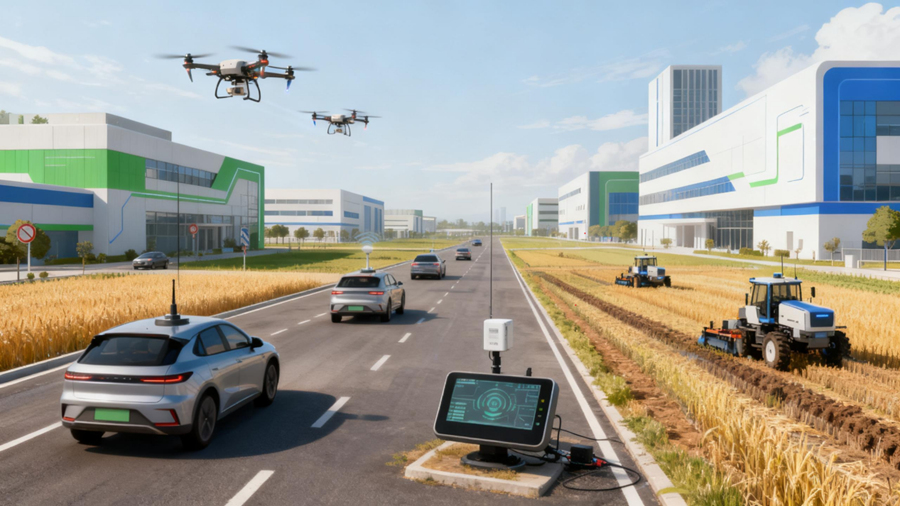




Agriculture is shifting from manual operation and uniform field management toward precision guidance, autonomous machinery, data-driven farming, and intelligent agricultural equipment. For agricultural UAVs, autonomous tractors, harvesting equipment, and planting machinery, reliable positioning is a fundamental requirement. This is where precision agriculture GNSS technology — particularly RTK GNSS — becomes essential, providing the centimeter-level positioning that enables automated guidance, repeatable operations, and location-based data collection across the farm.
Why High-Precision Positioning Matters in Precision Agriculture
Precision agriculture depends on managing fields at a spatial level — applying the right input at the right place and the right time. This requires accurate machine guidance, repeatable field operations, and precise data collection tied to geographic coordinates.
Standard GNSS positioning, typically accurate to a few meters, is insufficient for operations where centimeter-level precision directly affects productivity. Overlapping passes waste fuel, seed, and chemicals. Missed areas leave gaps that reduce yield. RTK GNSS addresses these problems by delivering centimeter-level positioning, enabling:
- Accurate machine guidance along planned paths
- Repeatable field operations across multiple passes and seasons
- Reduced overlap and reduced missed areas
- Precise field data collection for mapping and analysis
- Autonomous operation with stable, predictable navigation
For OEMs building agricultural equipment, the positioning layer is not an accessory — it is the foundation that makes precision agriculture possible. The accuracy of the GNSS module directly determines the quality of guidance, the consistency of operations, and the reliability of the spatial data the system produces.
How RTK GNSS Supports Autonomous Agricultural Machinery
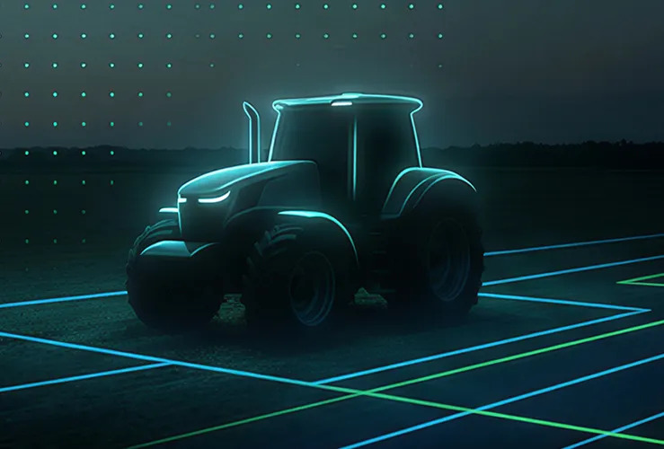
Autonomous tractors, harvesting equipment, planting machinery, tillage equipment, and spraying machinery all share a common requirement: they must know exactly where they are and where they need to go. RTK GNSS for precision agriculture provides the real-time, centimeter-level positioning that makes this possible.
RTK positioning works by combining a rover receiver on the machine with a base station or correction service that transmits correction data. The rover uses these corrections to resolve carrier-phase ambiguities and achieve positioning accuracy in the centimeter range. For agricultural machinery, this translates into several operational benefits:
- Stable guidance — The machine follows a planned route with minimal deviation, even at operating speeds.
- Repeatable navigation — The same path can be followed across multiple passes, essential for planting, spraying, and harvesting where consistency matters.
- Route control — The main controller uses GNSS position data to adjust steering, speed, and implement operation in real time.
GNSS positioning for agricultural machinery is typically integrated with a machine controller, IMU, and implement sensors. The GNSS module provides the position; the controller acts on it. This integration allows the machine to operate autonomously or semi-autonomously, reducing operator workload and improving the consistency of field operations. A GNSS receiver for autonomous tractors must deliver not only accuracy but also the update rate and interface compatibility that the machine controller demands.
RTK GNSS for Agricultural UAVs
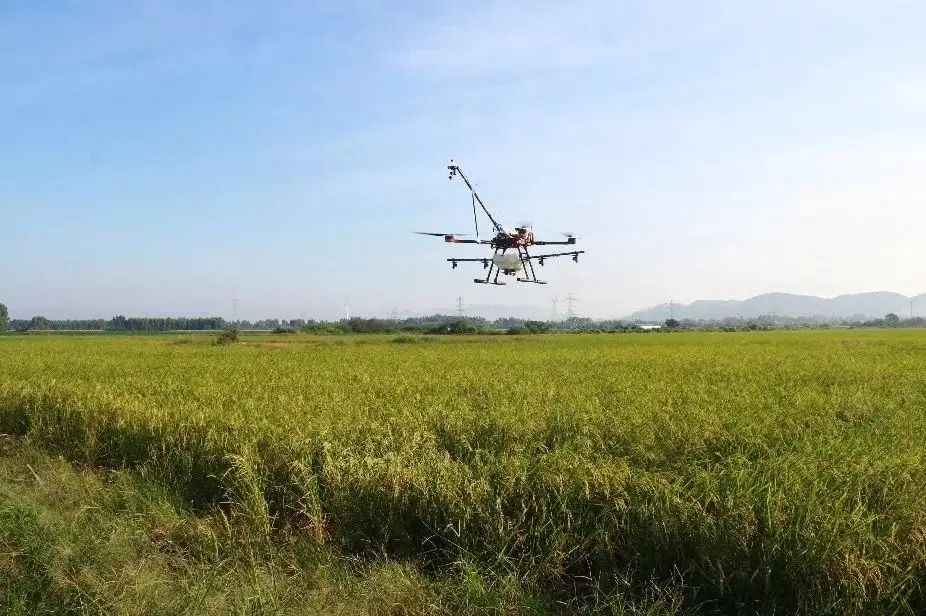
Agricultural UAVs rely on high-precision GNSS for crop monitoring, agricultural mapping, precision spraying, route planning, and repeatable flight paths. In large-area spraying operations, the difference between accurate and inaccurate positioning is measured in chemical waste, missed strips, and duplicated coverage.
Differential GNSS and RTK help agricultural drones fly along pre-planned routes with accurate positioning, maintain consistent flight paths across multiple sorties, reduce overlapping spray areas, minimize missed zones, and return to the exact previous operating location after refilling. High-precision GNSS also works with imaging systems — cameras, multispectral sensors, and other payloads — to collect georeferenced field data that helps identify crop conditions, pest distribution, disease patterns, and affected field locations with spatial accuracy.
In a UAV system, the GNSS module works alongside the flight controller, correction data link, GNSS antenna, sensors, and agricultural software. The module provides position; the flight controller uses it to maintain the route and execute the mission. For embedded UAV integration, compact RTK modules offer the best balance of accuracy, size, and power efficiency.
The JS-M6D is a compact dual-frequency RTK GNSS module measuring 22.0 x 17.0 x 2.4 mm, delivering 2 cm + 1 ppm positioning accuracy with an update rate of 1-10 Hz and a UART interface. Its small footprint and low power consumption make it suitable for size- and weight-constrained agricultural drone platforms. The JS-MK43 provides another compact option with dual-frequency RTK, an electronic compass, and support for GPS/BDS/GLONASS L1+L2 signals. For applications where standard-precision GNSS is sufficient, the JS-AD56UB8 offers a compact design with multiple interfaces (UART, I2C, CAN) and support for multiple GNSS constellation combinations.
GNSS for Field Mapping and Agricultural Data Collection
In precision agriculture, GNSS is not only used for navigation. It also serves as the spatial reference for field data collection. Typical applications include field boundary mapping, field area measurement, soil sampling with georeferenced locations, soil moisture mapping, crop condition mapping, and agricultural resource mapping.
The core function is straightforward: GNSS connects each agricultural measurement — whether a soil sample, a moisture reading, or a crop observation — with an accurate geographic coordinate. This allows agricultural producers and equipment systems to build precise spatial datasets that support decision-making.
For example, when a soil sampling device records nutrient levels, the GNSS position tells the system exactly where that sample was taken. When these points are aggregated, they form a field map that can guide variable-rate application, irrigation planning, and crop management strategies. Without accurate positioning, the spatial value of the data is lost — the measurements exist but cannot be tied to specific locations in the field. A GNSS module for precision agriculture therefore plays a dual role: it guides the machine and georeferences the data the machine collects.
GNSS Applications in Precision Irrigation
Precision irrigation requires managing water resources at a field level, accounting for differences in soil type, moisture, topography, and crop conditions across zones. GNSS supports this process by providing accurate location information for data collection and spatial analysis.
Specifically, GNSS positioning can be integrated with soil moisture sensors, temperature probes, and other field instruments to associate measurements with geographic coordinates. This enables soil moisture mapping at specific locations, spatial analysis of field conditions, location-based irrigation management, and agricultural resource planning.
It is important to note that GNSS itself does not directly control irrigation. Rather, GNSS provides the location framework that allows sensors, control systems, and agricultural software to build a spatial picture of the field. Irrigation decisions are then made based on this georeferenced data, which can support more efficient water use and better crop outcomes across zones with different characteristics.
GNSS for Automated Harvesting and Precision Farming Equipment
Automated harvesting equipment combines GNSS positioning with yield sensors, machine control systems, and agricultural software. During harvest, the machine collects yield and position data across different field zones. These data points are then used for yield mapping, field analysis, machine route planning, and agricultural decision-making.
The role of GNSS in this process is to provide accurate position and navigation information. The machine needs to know where it is and where it should operate next. The yield sensor records what is being harvested; the GNSS records where. Together, they produce a spatial yield map that would be impossible without accurate positioning.
This same principle applies to planting equipment, which can generate seed placement maps; tillage equipment, which can produce coverage maps; and spraying machinery, which can record application maps. In each case, RTK positioning for farming equipment provides the location layer that turns a machine operation into georeferenced agricultural data. The consistency and repeatability of RTK positioning means that the same field paths can be followed season after season, building a longitudinal dataset that supports long-term farm management decisions.
What to Look for in a GNSS Solution for Agricultural Equipment
When selecting a GNSS solution for agricultural equipment, OEMs and system integrators should evaluate several factors:
Positioning Accuracy
Match the accuracy class to the application. Standard positioning (meter-level) may suffice for basic tracking. Sub-meter positioning works for some data collection tasks. RTK centimeter-level positioning is required for autonomous guidance, precision planting, and repeatable field operations where accuracy directly affects input use and yield.
Update Rate
Dynamic agricultural machinery and UAVs need position updates fast enough for real-time control. Update rates of 1-10 Hz are common; higher rates may be needed for fast-moving equipment or tight-course UAV operations where latency in position feedback would affect guidance quality.
Power Consumption
Embedded equipment — especially battery-powered UAVs and autonomous robots — requires low-power GNSS modules to maximize operating time. Power budget is often a binding constraint in UAV design, and the GNSS module's consumption directly affects flight duration.
Size and Integration
Consider the physical dimensions, antenna requirements, interfaces, and mounting space. Compact modules are essential for UAVs and space-constrained machinery where every gram and millimeter matters.
GNSS Constellation and Frequency
Choose the appropriate constellation support (GPS, BDS, GLONASS, Galileo) and frequency configuration (single, dual, or triple frequency) based on accuracy requirements and operating environment. Dual-frequency RTK is increasingly the standard for high-precision agricultural applications.
Environmental Reliability
Agricultural equipment operates in demanding conditions — vibration, dust, temperature extremes, and prolonged outdoor exposure. The GNSS module must withstand these environments over the full operating life of the equipment.
Communication Interfaces
Ensure the module supports the interfaces required by the main controller — UART, CAN, I2C, or others. Interface compatibility simplifies integration and reduces development time.
JUMPSTAR GNSS Solutions for Precision Agriculture
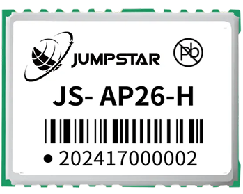
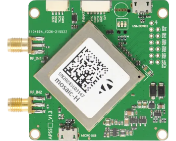
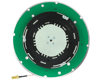
JUMPSTAR provides a range of GNSS positioning technologies designed for OEM integration across precision agriculture, UAVs, autonomous equipment, and other high-precision applications. The product portfolio includes GNSS modules, RTK positioning solutions, GNSS receivers, and GNSS antennas that can be integrated into agricultural machinery, drones, and embedded systems.
The JS-M6D is a compact dual-frequency RTK GNSS module measuring 22.0 x 17.0 x 2.4 mm, delivering 2 cm + 1 ppm positioning accuracy with an update rate of 1-10 Hz and a UART interface. Its small footprint and low power consumption make it suitable for embedded agricultural equipment, autonomous systems, and agricultural UAVs where space and power are constrained.
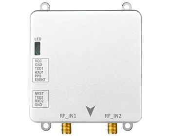
The JS-MK43 is a compact RTK positioning solution (47.0 x 37.0 mm) with dual-frequency RTK, 2 cm + 1 ppm accuracy, low power consumption, a UART interface, and an integrated electronic compass. It supports GPS/BDS/GLONASS L1+L2 signals and is well suited for agricultural machinery, UAVs, and embedded navigation equipment.
The JS-AD56UB8 is a compact GNSS positioning module (56.0 x 9.4 mm) designed for UAVs, intelligent robots, and ADAS applications. It features 72 acquisition channels and 24 tracking channels, tracking sensitivity of -167 dBm, an update rate of 1-10 Hz, and multiple interfaces (UART, I2C, CAN). With support for multiple GNSS constellation combinations and an electronic compass, it can be integrated into agricultural UAVs and intelligent equipment where its supported positioning performance is appropriate.
Building a GNSS-Based Precision Agriculture System
A GNSS-based precision agriculture system is built from multiple components working together:
- GNSS Module / Receiver — Provides position data (standard, sub-meter, or RTK centimeter-level depending on the module).
- GNSS Antenna — Receives satellite signals and feeds them to the module.
- RTK Correction Data — Base station or network correction service that enables centimeter-level accuracy.
- Main Controller — Processes GNSS position data alongside IMU, sensors, and implement feedback to control the machine or UAV.
- Agricultural Machinery / UAV — The platform that executes the operation.
- Agricultural Software / Data Platform — Aggregates georeferenced data for mapping, analysis, and decision-making.
In practice, GNSS works alongside the antenna, correction services, IMU, sensors, flight or machine controller, and agricultural software. Each component has a role, and the system's performance depends on the integration of all of them. JUMPSTAR provides the GNSS positioning components — modules, receivers, and antennas — that serve as the positioning foundation within this system architecture.
Conclusion
RTK GNSS provides the high-precision positioning foundation for precision agriculture. It enables autonomous agricultural machinery to follow planned routes with centimeter-level accuracy, supports agricultural UAVs in repeatable spraying and mapping operations, connects field measurements to geographic coordinates for data-driven management, and underpins applications from precision irrigation to automated harvesting.
For OEMs and system integrators building precision farming GNSS solutions, the choice of GNSS module, antenna, and correction strategy directly determines the system's accuracy, reliability, and integration complexity. An agricultural GNSS module selected with the right balance of accuracy, update rate, power consumption, and environmental robustness becomes the positioning backbone of the entire equipment platform.
JUMPSTAR provides GNSS positioning technologies designed for OEM integration across precision agriculture, UAVs, autonomous equipment, and other high-precision applications.
Contact JUMPSTAR to discuss your GNSS requirements for precision agriculture, agricultural UAVs, autonomous machinery, or embedded positioning systems.
Contact JUMPSTAR.png?imageMogr2/format/webp)
.png?imageMogr2/format/webp)