






For any system that depends on knowing exactly where it is — a survey rover, an autonomous tractor, a mapping UAV, a machine-control platform — the RTK GNSS receiver is the component that turns satellite signals into centimeter-level position. Standard GNSS receivers deliver a few meters of accuracy, which is useful for navigation but not for operations that must be repeatable to within centimeters. The RTK GNSS receiver closes that gap by processing carrier-phase measurements and real-time corrections, and it has become the de facto positioning engine across surveying, agriculture, autonomous driving, robotics, and UAV applications.
This article explains how an RTK GNSS receiver works, what determines its accuracy, why channels and multi-constellation tracking matter, and the key technologies inside a modern receiver. It is written for engineers, OEMs, and system integrators who need to specify or select a receiver for a real product, with practical criteria rather than marketing language.
What Is an RTK GNSS Receiver?
An RTK GNSS receiver is a positioning device that receives signals from GNSS satellites, applies differential corrections in real time, and outputs position at centimeter-level accuracy. The "RTK" in its name stands for Real-Time Kinematic, a technique that uses the carrier phase of the satellite signals — not just the code — to measure distance with far greater precision than standard code-based positioning.
A complete receiver typically combines several functions in one package:
- Signal reception and front-end filtering — capturing L-band signals from GPS, BDS, GLONASS, and Galileo constellations.
- Carrier-phase and code measurement — producing the raw observations used by the RTK engine.
- Correction handling — receiving RTCM-format corrections from a base station or network service over UART or other interfaces.
- RTK processing — resolving integer ambiguities and computing a fixed, centimeter-level solution.
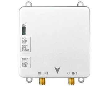
- Output interfaces — delivering position, velocity, and status data to a main controller through UART, CAN, I2C, or similar buses.
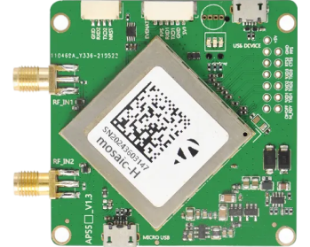
The result is a compact electronic component that can be embedded directly into a machine, a UAV, or a survey instrument. This is where modular designs matter: an OEM can integrate a ready-made RTK receiver or module instead of building the whole GNSS signal chain from scratch, which shortens development time and de-risks the positioning subsystem.
How RTK Achieves Centimeter-Level Accuracy
To understand RTK accuracy, it helps to separate the two measurement types a receiver can make. Code-based (pseudorange) measurements are quick but coarse — they place you within a few meters. Carrier-phase measurements track the phase of the radio wave itself, which is much finer, but they contain an unknown number of whole carrier cycles, the so-called integer ambiguity. Resolving that ambiguity is the core of RTK.
RTK solves the problem with a differential approach. A base station at a known position and the rover receiver observe the same satellites at the same time. Most of the errors common to both — satellite clock error, orbit error, ionospheric and tropospheric delay — largely cancel out in the difference. Once the receiver fixes the integer ambiguities, it can output a fixed solution at the centimeter level. If the ambiguities cannot be resolved, it falls back to a float solution, which is typically accurate to tens of centimeters.
This explains the classic accuracy specification of "2 cm + 1 ppm." The first part is the base accuracy achievable under good conditions. The second part reflects that differential errors grow slowly with distance from the base station — roughly 1 cm per kilometer of baseline. For most field applications within a few kilometers of a base, or with a well-placed network correction service, the user should expect repeatable centimeter-level performance in open-sky conditions.
For a deeper comparison of RTK with other correction methods such as PPK, see our guide on RTK vs. PPK correction methods.
Accuracy: What Determines It in Practice
Specified accuracy is achieved under ideal conditions. In the field, several factors determine the accuracy an RTK GNSS receiver actually delivers:
- Satellite geometry — more satellites spread across the sky produce a stronger geometry and faster, more reliable ambiguity resolution.
- Signal environment — open sky is best; tree canopy, building walls, and terrain can block or reflect signals and degrade or interrupt RTK fixes.
- Baseline length — with a single base station, accuracy degrades slowly with distance; network RTK mitigates this with a regional correction model.
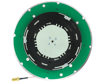
- Antenna quality — the antenna feeds the receiver, and its phase-center stability and multipath rejection directly affect the solution.
- Correction data quality — the receiver can only be as good as the corrections it receives; latency and gaps matter.
For an OEM, the practical implication is that the receiver must be paired with a suitable antenna and a reliable correction source. The receiver alone does not guarantee accuracy; the whole signal chain — antenna, receiver, corrections, and mounting environment — must be engineered together.
Channels: What They Are and Why They Matter
A receiver channel is a hardware resource that tracks one satellite signal at a time. A receiver with more channels can track more satellites simultaneously, which matters more than many buyers assume. Multi-constellation support — GPS, BDS, GLONASS, and Galileo — only helps if the receiver has enough channels to track satellites from all constellations at once.
More channels and more tracked satellites translate into concrete benefits:
- Better availability — in obstructed environments such as tree lines, urban canyons, or around machinery, some satellites are blocked; extra tracked satellites keep the solution alive.
- Faster RTK initialization — more observations give the ambiguity-resolution engine more data to work with, shortening the time to a fixed solution.
- Better geometry — a wider spread of satellites improves dilution of precision and therefore accuracy.
- Redundancy — a constellation-specific outage is less likely to interrupt operation when others are still tracked.
Modern receivers commonly support 30, 40, or more channels spanning multiple frequencies. The specific requirement depends on the application: an open-field agricultural machine can often work with a moderate channel count, while a vehicle operating near buildings or trees benefits from maximum constellation coverage. Our article on multi-constellation GNSS and L1/L2/L5 frequency bands explains the frequency side of this trade-off in more detail.
Key Technologies Inside a Modern RTK GNSS Receiver
Several technologies work together inside a modern RTK GNSS receiver, and they are worth understanding because they explain real differences between products:
Multi-Frequency Tracking
A dual-frequency receiver tracks signals on two bands, such as L1 and L2, allowing it to estimate and remove ionospheric delay, which is the largest source of atmospheric error in GNSS. Dual-frequency RTK resolves ambiguities faster and more reliably than single-frequency RTK, which is why dual-frequency is now the baseline for serious RTK applications. Triple-frequency tracking adds a third band (for example L5 or BDS B2) for even faster initialization and better robustness.
Multi-Constellation Engine
GPS alone is no longer the default assumption. Receivers that also track BDS, GLONASS, and Galileo gain more satellites, which improves availability and reliability, especially where sky visibility is limited. An RTK engine that handles observations from multiple constellations can maintain a fixed solution where a single-constellation receiver would drop back to float or lose lock.
Real-Time Correction Handling
RTK depends on a stream of correction data, usually in RTCM 3.x format, received from a base station or network service. The receiver must parse this stream, apply the corrections, and react quickly if the stream is interrupted. In practice, the robustness of correction handling determines how gracefully a receiver behaves at the edge of coverage.
Interference Mitigation and Filtering
Agricultural machinery, vehicles, and UAVs operate in electrically noisy environments. Front-end filtering, interference rejection, and multipath mitigation algorithms help the receiver stay locked on weak or contaminated signals. These features are hard to see in a spec sheet but have a large effect on field reliability.
Sensor Fusion Ready
Many applications fuse GNSS with an IMU so that position continues to be estimated during short GNSS outages — under a bridge, beside a building, or through a tree line. The receiver supports this by outputting raw measurements at a sufficient update rate and by exposing a clean interface for the fusion engine. Some modules integrate a compass or other sensors on the same package to simplify system design.
Low Power and Compact Integration
For battery-powered and space-constrained platforms — UAVs, handheld survey tools, robots — power consumption and size are first-class requirements. Modern RTK receivers are increasingly delivered as compact modules with embedded designs that can be soldered or cabled directly into a motherboard, dramatically reducing integration effort compared with a full stand-alone receiver box.
RTK GNSS Receiver vs. Standard GNSS Receiver
The choice between a standard receiver and an RTK receiver is really a choice about the accuracy the application needs:
- Standard GNSS receiver — meters-level accuracy, no corrections required, low cost and complexity. Suitable for basic navigation, fleet tracking, and applications where absolute position within a few meters is enough.
- RTK GNSS receiver — centimeter-level accuracy, requires corrections from a base station or network service, higher cost and complexity. Necessary for survey, precision agriculture, machine control, autonomous vehicles, and any operation that must be repeatable to centimeters.
There is a middle ground: sub-meter receivers with SBAS or PPP support that improve on standalone accuracy without the infrastructure of RTK. The right choice depends on the positioning error budget of the end product, the operating environment, and the available correction infrastructure.
How to Choose an RTK GNSS Receiver for Your Application
OEMs and integrators evaluating RTK GNSS receivers should look beyond headline accuracy and consider the full set of engineering constraints:
Positioning Accuracy and Fix Reliability
Confirm the expected accuracy class — centimeter-level for RTK — and, just as important, how reliably and how quickly the receiver reaches a fixed solution in the target environment. Ask for performance under the conditions the product will actually face, not just ideal open-sky numbers.
Update Rate
A survey rover may be fine with 1 Hz, but a fast-moving UAV or a vehicle control loop needs higher rates, typically 5–10 Hz or more. The update rate must match the dynamics of the platform and the control loop it feeds.
Channels, Constellations, and Frequencies
Match the constellation and frequency support to the operating region and environment. In North America and Europe, GPS and Galileo coverage is strong; in Asia, BDS adds valuable redundancy. Dual-frequency support is recommended for reliable RTK performance.
Interfaces and Integration
Check the electrical interfaces — UART, CAN, I2C — against the main controller. Confirm the protocol and data format, whether RTCM correction input is supported on the expected port, and whether the module fits the mechanical and electrical design of the product.
Power Consumption
For battery-powered platforms, power draw at the required update rate should be evaluated in the context of the whole system, not as an isolated number.
Environmental Reliability
Agricultural and outdoor equipment is exposed to vibration, temperature extremes, dust, and moisture. Confirm the receiver operating temperature range and the robustness of its connectors and housing for the intended environment.
Firmware and Long-Term Support
A receiver is only useful if it integrates cleanly and keeps working across product generations. Evaluate the availability of documentation, firmware updates, custom configuration support, and the supplier's ability to support volume production.
JUMPSTAR RTK GNSS Receivers for OEM Integration
JUMPSTAR designs and manufactures GNSS modules and positioning solutions for OEM integration across precision agriculture, UAVs, autonomous systems, surveying, and industrial equipment. The product line covers compact RTK modules, GNSS receivers, antennas, and embedded positioning solutions engineered for real products rather than laboratory demos.
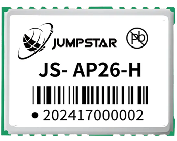
The JS-M6D is a compact dual-frequency RTK module with a 22.0 × 17.0 × 2.4 mm footprint, positioning accuracy of 2 cm + 1 ppm, an update rate of 1–10 Hz, and a UART interface. Its low power consumption and embedded design make it a practical building block for agricultural equipment, autonomous systems, and professional UAVs that need centimeter-level positioning inside a tight mechanical envelope.
The JS-MK43 combines dual-frequency RTK positioning (2 cm + 1 ppm) with a compact cylindrical form factor of Φ47.0 × 37.0 mm, low power consumption, a UART interface, and an integrated electronic compass. It supports GPS/BDS/GLONASS on L1+L2, which makes it a convenient RTK positioning solution for agricultural machinery, UAVs, and embedded navigation equipment where heading and position are needed in a single compact package.
For platforms that need flexible, multi-interface positioning rather than RTK, the JS-AD56UB8 offers a compact Φ56.0 × 9.4 mm design with UART, I2C, and CAN interfaces, 72 acquisition channels and 24 tracking channels, multiple GNSS constellation combinations, and standard or custom firmware. With low noise, high gain, and low power consumption, it can support agricultural UAVs and intelligent equipment where its positioning performance class is appropriate.
JUMPSTAR works with OEMs through specification, samples, integration support, and volume production, so the receiver is selected and validated for the actual application rather than adapted after the fact.
Building a GNSS-Based Positioning System Around an RTK Receiver
An RTK GNSS receiver does not work in isolation. A complete positioning system for an agricultural machine, UAV, or autonomous vehicle typically includes:
- RTK GNSS receiver or module — the positioning engine described in this article.
- GNSS antenna — chosen for the frequency bands and the multipath environment of the application.
- Correction source — a base station, an RTK network service, or an NTRIP connection delivering RTCM corrections.
- Main controller — the computer that consumes position data and runs guidance, control, or data-logging logic.
- Optional IMU or sensors — for dead reckoning during short GNSS outages and for attitude estimation.
- Application software — the layer that turns position into behavior: guidance lines, spray control, mapping, or harvest logging.
For an OEM, the practical consequence is that the receiver must be specified together with the antenna, the correction service, and the control software. A receiver that performs well on the bench may disappoint in the field if the antenna is poor, the corrections are unreliable, or the integration introduces noise into the signal path.
Conclusion
The RTK GNSS receiver is the positioning foundation for a growing range of products that must know where they are to within centimeters: survey systems, precision agriculture equipment, autonomous vehicles and robots, and professional UAVs. Its accuracy comes from carrier-phase processing and real-time corrections, its robustness from channels and multi-constellation tracking, and its practicality from the integration technologies — multi-frequency support, interference rejection, sensor fusion, and low-power compact design — that make it embeddable in real products.
When selecting a receiver, match the accuracy class, update rate, constellation and frequency support, interfaces, power, and environmental reliability to the application, and validate the whole signal chain rather than the receiver alone.
Need an RTK GNSS receiver for your product?
JUMPSTAR provides compact RTK modules, GNSS receivers, and antennas designed for OEM integration across precision agriculture, UAVs, autonomous equipment, and high-precision applications.
Contact JUMPSTAR for Your GNSS Requirements.png?imageMogr2/format/webp)
.png?imageMogr2/format/webp)